Advanced Aerial Imaging & Geospatial Data Solutions for Richmond
Successful aerial acquisition, whether for detailed surveys or high-fidelity photography in the Richmond area, undeniably requires more than simply an available helicopter. It demands comprehensive mission planning, precise sensor integration, and navigating complex regulatory approvals. At Helicopters Over Richmond, we position ourselves as your dedicated mission commander for these critical operations. We thoroughly assess your specific data or footage requirements, meticulously select the optimal airframe and highly experienced flight crew best suited for your precise mission profile, and manage all necessary flight planning and permit acquisition. This integrated approach ensures you benefit from a single point of accountability, receiving a complete, turnkey result that aligns perfectly with your project objectives.
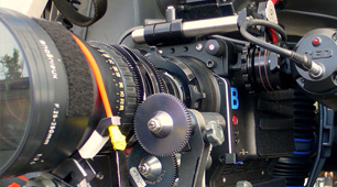
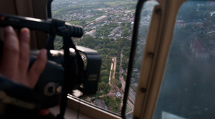
Cinema & Broadcast Videography
For film production and live broadcast events across Virginia, we provide the critically stable, high-performance helicopter platforms that Directors of Photography require for exceptional aerial cinematography. We fully support and integrate industry-standard stabilization systems, including Shotover, Cineflex, and Tyler Mounts, ensuring compatibility with your existing equipment. Our operational approach involves seamless coordination with your production crew from pre-flight planning through execution, guaranteeing the precise flight profiles necessary for perfect shot acquisition and achieving your creative vision without compromise.
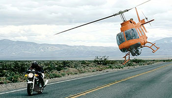
Aerial Photography
For businesses and developers in Richmond, we enable the capture of high-resolution marketing assets, compelling real estate portfolios, and essential progress documentation. Our experienced flight crews possess a keen understanding of optimal lighting, photographic angles, and compositional principles, ensuring the delivery of truly magazine-quality aerial stills that elevate your visual content.
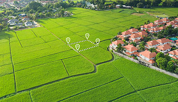
LiDAR & Geospatial Surveying
We deliver actionable geospatial data, extending capabilities beyond the visible spectrum. This includes precise LiDAR acquisitions, high-resolution orthomosaic mapping, and precise 3D terrain modeling. Such data is vital for informed urban planning, critical utility inspections, and effective environmental monitoring for projects throughout the Richmond and Central Virginia region.
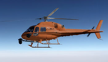
Utility & Asset Inspection
We provide rapid, detailed inspections of transmission lines, pipelines, and cell towers. Helicopters offer the stable hover and flight precision vital for high-fidelity asset auditing, ensuring comprehensive data capture for infrastructure projects around Richmond, Virginia.
Technical FAQ
We configure helicopter platforms for all major industry mounts, ensuring full compatibility. This includes systems like Shotover (F1, K1), Cineflex, and Wescam. For lighter cinema payloads, we support Tyler Minigyro and Middle mounts, providing comprehensive options for aerial productions.
Yes, we fully manage all airspace authorizations and flight plans required for urban aerial operations. Navigating complex controlled airspace, especially around Richmond's more densely populated areas, demands expertise. We ensure every flight is conducted legally and safely, delivering the precise imagery you need without logistical burden.
We offer flexible solutions tailored to your project. We can provide a skilled sensor operator for a turnkey service, or fly your creative team. If your crew joins for aerial work around Richmond, we will brief them thoroughly on safety and air-to-ground coordination protocols to ensure a secure operation.
We deliver raw point clouds (LAS/LAZ), orthomosaic maps (TIFF/ECW), or processed 3D meshes, depending on the sensor payload. We work directly with your GIS team to ensure full file compatibility and seamless integration for your projects in Richmond.
Gallery
Aerial Photography
Camera Equipment
Camera Mounts

Damage Survey
Real Estate Survey
Aerial Videography
Complete Aerial Photography and Videography Services for Richmond
For a fast, free quote on helicopter aerial photography in Richmond, call Helicopters Over Richmond at 1-855-445-8965. We are ready to assist with your project needs.